
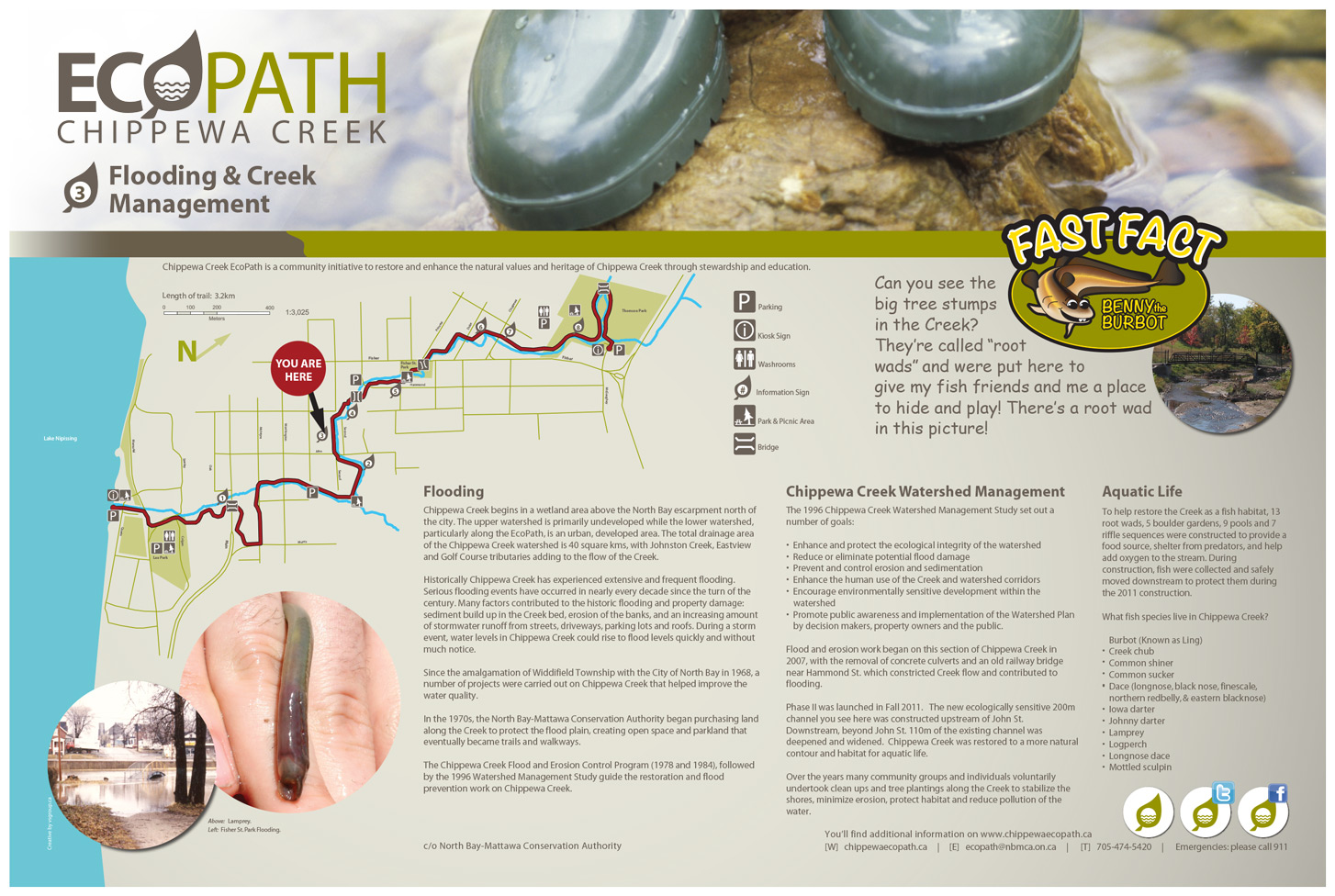
"Can you see the big tree stumps in the Creek? They're called "root wads" and were put here to give my fish friends and me a place to hide and play! There's a root wad below in the middle picture to the right!"

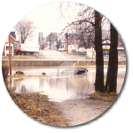
Flooding
Chippewa Creek begins in a wetland area above the North Bay escarpment north of the city. The upper watershed is primarily undeveloped while the lower watershed, particularly along the EcoPath, is an urban, developed area. The total drainage area of the Chippewa Creek watershed is 40 square kms, with Johnston Creek, Eastview and Golf Course tributaries adding to the flow of the Creek.
Historically Chippewa Creek has experienced extensive and frequent flooding. Serious flooding events have occurred in nearly every decade since the turn of the century. Many factors contributed to the historic flooding and property damage: sediment build up in the Creek bed, erosion of the banks, and an increasing amount of stormwater runoff from streets, driveways, parking lots and roofs. During a storm event, water levels in Chippewa Creek could rise to flood levels quickly and without much notice.
Since the amalgamation of Widdifield Township with the City of North Bay in 1968, a number of projects were carried out on Chippewa Creek that helped improve the water quality.
In the 1970s, the North Bay-Mattawa Conservation Authority began purchasing land along the Creek to protect the flood plain, creating open space and parkland that eventually became trails and walkways.
The Chippewa Creek Flood and Erosion Control Program (1978 and 1984), followed by the 1996 Watershed Management Study guide the restoration and flood prevention work on Chippewa Creek.
Chippewa Creek Watershed Management
The 1996 Chippewa Creek Watershed Management Study set out a number of goals:
- Enhance and protect the ecological integrity of the watershed
- Reduce or eliminate potential flood damage
- Prevent and control erosion and sedimentation
- Enhance the human use of the Creek and watershed corridors
- Encourage environmentally sensitive development within the watershed
- Promote public awareness and implementation of the Watershed Plan by decision makers, property owners and the public.
Flood and erosion work began on this section of Chippewa Creek in 2007, with the removal of concrete culverts and an old railway bridge near Hammond St. which constricted Creek flow and contributed to flooding.
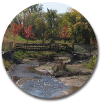
Phase II was launched in Fall 2011. The new ecologically sensitive 200m channel you see here was constructed upstream of John St. Downstream, beyond John St. 110m of the existing channel was deepened and widened. Chippewa Creek was restored to a more natural contour and habitat for aquatic life.
Over the years many community groups and individuals voluntarily undertook clean ups and tree plantings along the Creek to stabilize the shores, minimize erosion, protect habitat and reduce pollution of the water.
Aquatic Life
To help restore the Creek as a fish habitat, 13 root wads, 5 boulder gardens, 9 pools and 7 riffle sequences were constructed to provide a food source, shelter from predators, and help add oxygen to the stream. During construction, fish were collected and safely moved downstream to protect them during the 2011 construction.
What fish species live in Chippewa Creek?
- Burbot (Known as Ling)
- Creek chub
- Common shiner
- Common sucker
- Dace (longnose, black nose, finescale, northern redbelly, & eastern blacknose)
- Iowa darter
- Johnny darter
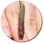
- Lamprey
- Logperch
- Longnose dace
- Mottled sculpin